Drawno
http://www.drawno.pl
The District of Drawno
area: 321 km 2
population: 5 340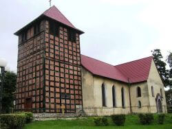
The marks of settlement on the territory of Drawno and its region come back to the Stone Age, however most of the marks of the human activity remained after the Middle Ages.
- At first the territory belonged to Brandenburg, but in the course of time it was turned over by the family of Welds
- Between 1313 and 1333 Drawno was given the city rights, which was first called Neven wede, “Nien Wedel”, later Neuwedel-which meant “New Wedel”
- In the years 1433-1436 Drawno was located within the border of Poland
- Later on it was within the jurisdiction of : the Order of Teutonic Knights, the family of Hohenzollern and Western Pomerania District
- Fires at the end of the XVIth and XVIIIth century damaged the city development
- Around 1600 the castle which was located within the border of the city was rebuilt into a Renaissance residence, however in 1675 it was destroyed by Swedes, and then in 1758 by Russians
- In 1912 a power line was pulled through Drawno from the hydro power station in G?lusk to Choszczno
- Until 1938 the town belonged to Nowa Marchia (Brandenburg)
- In the years 1938-1945 it was under the Pomeranian Province authority
- 25% of buildings were destroyed during the World War II
- In 1945 the town was liberated
- Drawno at first was called “New upon the River Drawa”, later on Knia? and finally it was given the present name
- Until 1975 it was included in the Szczecin Province, and in the years 1975-1999 to the Gorzów Province and at present it is located witin the southern part of the West Pomeranian Province in the Choszczno County


